
Start a Hawaiʻi Street Directory Trail at the Address
A street directory search follows address-keyed records one parcel at a time. In Hawaiʻi, the Tax Map Key (TMK) joins the county map and assessor to the statewide deed office. An owner name is not proof of occupancy; label each result by source and date.
- Search the county property portal or map; note the parcel’s TMK.
- Open that TMK in the assessor; record site, owner, and sales fields shown.
- Use the TMK or deed number in Hawaiʻi’s Bureau of Conveyances index.
- Use voter channels only for their limited public fields and status checks.
- For a past household clue, compare a dated street index with the address and TMK.
Assessments, permits, deeds, and directory entries document a record connection, not everyone in a present household.
Address Records Behind the Hawaiʻi Street Directory
Hawaiʻi’s address sources answer different questions. Property records show tax fields, GIS maps parcels, the statewide Bureau of Conveyances records land instruments, and permit and election sources add limited context.
| Address Record | Hawaiʻi Custodian | Street-Level Clue | Available Route |
|---|---|---|---|
| Assessment / tax | County real-property office | Owner/taxpayer, addresses, values, class, exemptions | Portal, office, or records request |
| GIS parcel | County GIS | Parcel shape, TMK, nearby polygons, selected overlays | Public map/service; not legal survey |
| Deed / land instrument | State Bureau of Conveyances | Parties, date, document number, legal description, book/page | Account search, paid image, counter, older-record request |
| Permit / code file | County planning offices | Project parties, address/TMK, permit number, status | Status portal; full file by office or UIPA request |
| Voter fields | State and county elections offices | Public name, district/precinct, and status only | Self-check, phone, paper form; restricted details |
| Street index | Archives and libraries | Dated address-to-name or subscriber clues | Selected digital volumes, shelves, microfilm, staff |
Use the TMK to move from map to assessment, deed, or permit. One postal number can cover several lots or units, and voter fields do not list everyone at a house.
Turn a Hawaiʻi Street Address into a TMK
There is no statewide assessor search. Honolulu serves Oʻahu, Hawaiʻi County serves Hawaiʻi Island, Maui County covers Maui, Molokaʻi, and Lānaʻi, and Kauaʻi County includes Kauaʻi and Niʻihau. Kalawao is a county-equivalent with no ordinary county-seat counter. Route by island and county first.
TMK format varies. Oʻahu uses Zone-Sector-Plat:Parcel, often 0-0-000:000, with a leading 1 for Oʻahu and possible CPR/unit suffixes. Hawaiʻi County metadata uses an eight-digit key; Kauaʻi map fields include TMK, parcel text, acreage, and a property link. Use county guidance, not a statewide parser.
Address terms. Parcel: mapped tax unit. Situs: physical site address. Plat: recorded lot map. Criss-cross directory: names indexed by address for a dated run.
A postal city, island, ahupuaʻa, subdivision, lot, and legal description can describe overlapping parts of one place. If an address search misses, try the county format or map rather than assuming no record exists.
Assessor Search Fields for a Hawaiʻi Street Directory
Honolulu’s qPublic assessment search has owner, address, and TMK modes. Maui’s county FAQ lists address, TMK, owner, map, and sales modes. Hawaiʻi County GIS exposes shape and TMK but not ownership; use the county tax portal next. Kauaʻi’s TMK/parcel number is its numeric key. Live search fields for Hawaiʻi County and Kauaʻi were not confirmed.
| Search Field or Mode | Entry / Result | What It Does | County Note |
|---|---|---|---|
| Site / location address | Text or autocomplete | Finds the physical parcel; abbreviations or units affect matches | Honolulu and Maui |
| Owner name | Name text | Searches the owner/taxpayer index where supported | Honolulu and Maui |
| TMK / parcel ID | County-formatted parcel key | Connects map geometry to the assessment record | Most stable cross-record key; formats vary |
| Map selection | Click parcel or map | Finds property when address wording is uncertain | Maui search; GIS identify/query |
| Sales search / list | Portal mode or history | Transaction clue; Honolulu may show deed number | Maui modes; Honolulu history |
| Assessment / description | Returned fields | Land, building, size, class, value, exemptions | Varies by county |
| Mailing address | Taxpayer field | Notice address may differ from the site | Availability varies |
Open the Honolulu qPublic search to see its address, owner, and TMK paths.
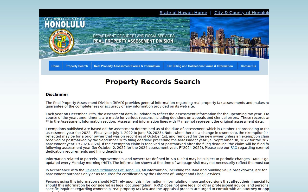
It is a county property interface, not a statewide resident roll; automated access may be challenged.
Maui County’s property tax portal documents address, TMK, owner, map, and sales modes.
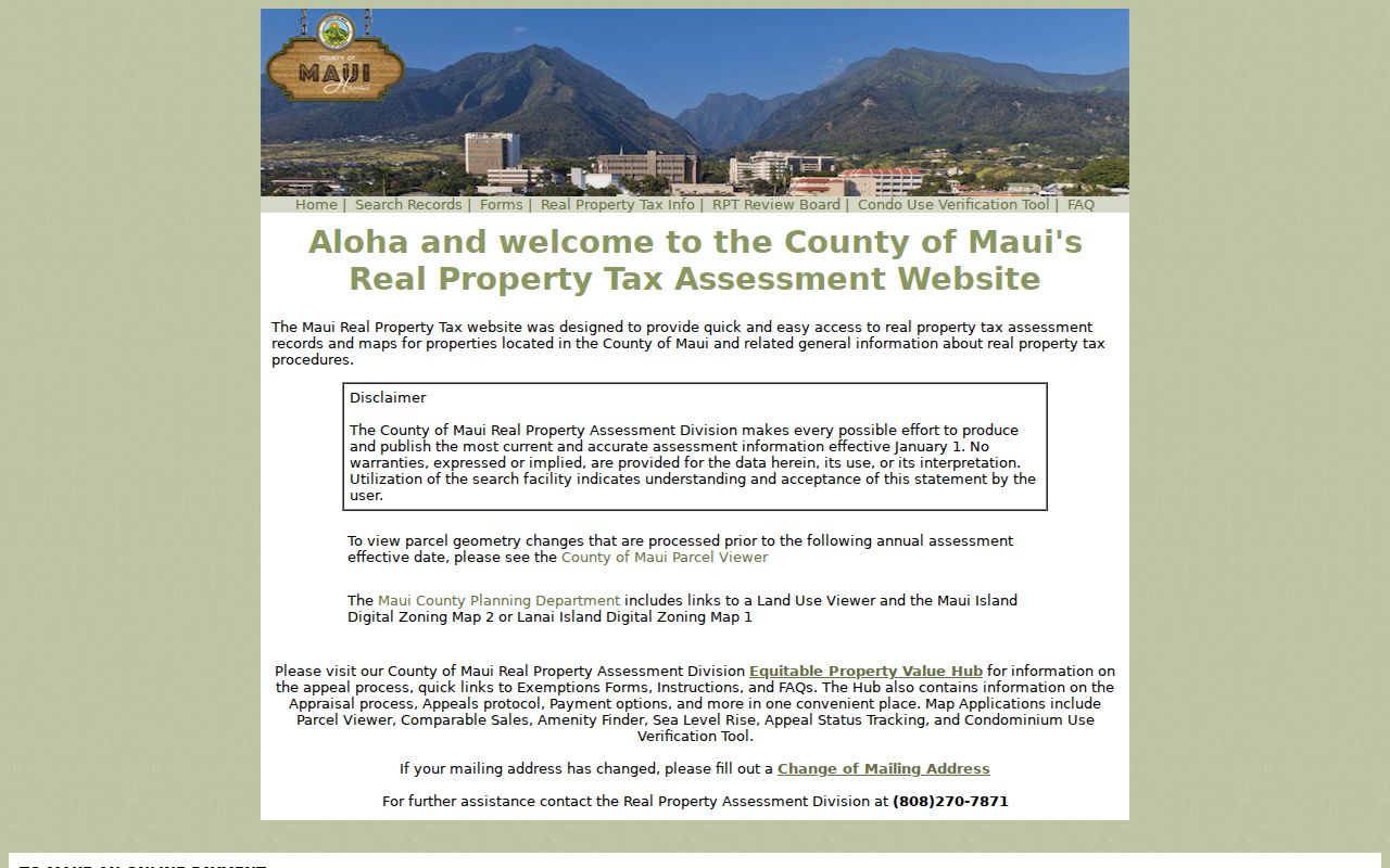
Maui Public Documents adds permit and ownership-history material; its FAQ calls TMK the most complete key.
A Honolulu Sales Result Can Point into the Hawaiʻi BOC Index
Hawaiʻi insider tip: inspect an assessor result before opening the deed index. Honolulu sales history can expose a deed document number, a direct lead into the statewide Bureau of Conveyances. The tax page summarizes assessment and sale fields; the instrument supplies parties and a legal description.
Honolulu records may show site address, TMK, owner, mailing address, assessments, tax class, exemption, lot and building description, value, consideration, and deed number. A home exemption is a tax classification under city rules, not proof that every person at the address lives there.
Copy the document number as shown: BOC formats changed over time. TMK and instrument number help distinguish repeated names and multiple parcels on an Oʻahu street.
Walk Hawaiʻi GIS Parcels Along a Street
GIS is a map layer, not a title authority. Identify the address polygon and TMK; repeat for touching parcels, then take each key to the assessor if the map shows no owner. State and county GIS layers add local parcel and planning details.
Honolulu maps show TMK plus flood, zoning, SMA, and warning overlays. Kauaʻi’s parcel service has TMK, parcel text, acreage, alternate IDs, and a property link. Hawaiʻi County’s public layer has geometry and TMK but no owner data.
Kauaʻi warns that boundaries are illustrative, some CPR units are unmapped, and polygons are not surveys. Hawaiʻi County says its layer is not metes-and-bounds accuracy. Roads, common elements, shorelines, and empty lots can distort a street sweep.
Follow a Hawaiʻi TMK into the State Bureau of Conveyances
Hawaiʻi has a statewide Bureau of Conveyances (BOC), not a county recorder. It records Regular System and Land Court deeds, mortgages, liens, plats, and condominium instruments. In RecordEASE, search party name, document number, TMK, or legal fields such as lot, block, and plat. Registered users search without charge and pay for images or a subscription.
For a street-wide chain, note each result’s date, type, parties, document number, book/page, related documents, and legal description. Group by TMK: one street number may cover multiple lots or units. A deed shows a land interest, not everyone who lived there.
Before ordering, transcribe the index fields rather than saving only a name: recording date, document group and type, document number, related document numbers, certificate number, book type, book, page, tax ID or TMK, grantor and grantee names, and image or order link. Fields vary by instrument, and the Bureau warns that document-number formats changed over time. Related numbers can lead to amendments or another instrument; certificate and book/page details help staff locate a result when online access stops. Treat these fields as search clues, not an occupancy timeline.
Pre-1976 material may need a written request or in-person research. The form asks for contact details, party names, date/type, property or TMK clues, copy choice, payment, and a stamped return envelope. BOC lists $35 per document plus $10 processing. Staff and research equipment are at Kalanimoku; the Bureau FAQ explains the fallback.
Permit Searches Add Dates to Hawaiʻi Street Records
Permit files tie a project, applicant, contractor, address/TMK, permit number, and status to a place; an applicant is not necessarily an occupant. On Oʻahu, check Honolulu’s online permit-status search. Full plans and files require the permitting office’s records-view or UIPA route; code records have a separate office channel.
Maui Public Documents offers “All Docs for TMK,” MAPPS permits from April 18, 2022, approved plans, plats, planning files, and ownership-history books through 1987. It accepts wildcards and identifies TMK as the most complete search key. Full files may still require a county office or written request.
Hawaiʻi County’s GIS omits ownership; Kauaʻi’s parcel service links map data to property details. Under Hawaiʻi’s UIPA, the Office of Information Practices explains request and redaction rules for records held by a government office.
A Hawaiʻi Voter Lookup Is Not a Street Address List
Hawaiʻi’s voter tool is for a person’s own registration, update, or status check, using a state ID or driver license and the last four Social Security number digits. The Online Voter Registration system is credential-gated; paper forms and phone help are available through the county. Neighbor-island phone lines are 800-442-VOTE; the main line is 808-453-VOTE.
HRS §11-97 makes full name, precinct/district, and status public. Other affidavit details are confidential except for election or government use; public fields omit full DOB, SSN, license, phone, email, and ballot choice. Qualifying people may also request address confidentiality.
Contact a county elections division about paper forms or proof of registration. A missing online result says nothing about every person on a street; bulk files have restricted purposes.
Use a Dated Hawaiʻi Street Index for Past Address Clues
A street index is a dated address clue, not a current occupancy list. The State Archives Polk/Husted collection has digitized years from 1880 to 1924. Other shelves and phone books have their own year and subscriber gaps.
Record the exact number and spelling, follow the index page, then compare adjacent years and the TMK. Island and language variants can shift a name. The full historical shelf is on the Hawaiʻi city directory page; this street directory uses the past entry only to understand an address clue. Archives, libraries, microfilm, and reference staff are fallbacks when a scan is missing.
Island Address Changes Complicate Hawaiʻi Street Searches
A Hawaiʻi address may combine island, district, ahupuaʻa, subdivision, postal city, lot, and TMK. A street name or number may change while the legal description stays stable. Compare dated maps and directory pages with parcel keys and deeds to bridge that gap.
No statewide renumbering authority or chronology was located, so do not assign a year to an unnamed change. Oʻahu address verification goes through county staff; Maui offers address checks by street or TMK. Elsewhere, ask the county planning or real-property office and preserve the TMK while comparing sources.
What a Hawaiʻi Street Directory Cannot Confirm
Hawaiʻi address sources do not show every person connected with a home. Tax records center on owners, permits on projects, deeds on land interests, and directories on selected years. Household members, protected residents, utility customers, and delivery recipients may not appear. DMV data is restricted; utility and delivery details are not public address indexes.
Voter fields are narrow, courts may seal records, and eligible Address Confidentiality Program participants use a substitute address. Redaction rules also apply to recorded instruments. A missing result does not prove someone never lived there; ask the custodian about search or correction steps.
Lawful use. Use Hawaiʻi street records for lawful personal research, family history, and civic understanding. Do not use a record to stalk, harass, threaten, or expose a person who has taken steps to keep an address private.